








About Brownsville
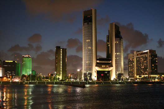
Brownsville is a city in the U.S. state of Texas and the largest city and county seat of Cameron County, located on the western Gulf Coast in South Texas, adjacent to the border with Matamoros, Tamaulipas, Mexico. The city covers 145.2 sq mi (376.066 km2), and had a population of 186,738 at the 2020 census. As of the 2020 U.S. census, it is the 136th-most populous city in the United States and 18th-most populous in Texas. It is part of the Matamoros–Brownsville metropolitan area. The city is known for its year-round subtropical climate, deep-water seaport, and Hispanic culture.
Cheap flights to Brownsville
The lowest round-trip fare found by Destina Holidays travellers in the last 30 days was $733 from New York, travelling 27 Nov – 4 Dec. These are the cheapest fares from the most searched cities.
Airlines travellers compared most often: United Airlines.
Prices are per adult in US dollars, taken from searches between 12 Oct and 11 Nov 2026. Fares change often, so search your dates for live prices.
Search flights to BrownsvillePlaces to visit in Brownsville
-

Gladys Porter Zoo
Zoo · 1 mi from centreA well-regarded zoo where animals are displayed in open settings separated by waterways rather than bars, including gorillas, rhinos and many endangered species, among lush subtropical plantings.
-

Palo Alto Battlefield National Historical Park
Historic · 6 mi from centreSite of the first major battle of the Mexican-American War, with a visitor center explaining both sides of the conflict and a short trail out to an overlook of the open battlefield.
-

South Padre Island
Beach · 29 mi from centreA barrier island east of Brownsville with long sandy beaches, warm Gulf water, water sports and a sea turtle rescue center, making it the area's top beach escape.
-

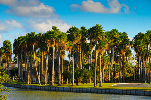
Sabal Palm Sanctuary
Nature · 7 mi from centreOne of the last remaining stands of native palm forest along the Rio Grande, with trails, a historic plantation house and excellent birdwatching in a subtropical setting.
-
Historic Brownsville Museum
MuseumHoused in a restored Spanish Colonial style train depot, it covers the region's history with exhibits on border life, ranching, the river and early transportation.
Best time to visit Brownsville
Based on recent weather records, the most comfortable time to visit Brownsville is February to March and November, when average daytime highs are around 75–83°F and rain falls on about 5 days a month.
Average daily low and high temperatures and days with at least 1 mm of rain, from recent weather records. Highlighted months are the most comfortable for sightseeing.
Brownsville weather forecast
- Wed 11 Nov 72° 64° 11%
- Thu 12 Nov 74° 64° 8%
- Fri 13 Nov 80° 67° 0%
- Sat 14 Nov 82° 69° 17%
- Sun 15 Nov 80° 69° 16%
- Mon 16 Nov 78° 71° 19%
Know before you go
- Currency
- United States dollar (USD)
- Language
- English
- Calling code
- +1
- Driving
- On the right
- Time zone
- America/ChicagoUTC−6
- Capital
- Washington, D.C.
Upcoming public holidays in United States
- Veterans Day
- Thanksgiving Day
- Christmas Day
- New Year's Day
- Martin Luther King, Jr. Day
- Presidents DayWashington's Birthday
Banks, offices and some attractions may close on public holidays, and flights and hotels often fill up early around them.
Getting to Brownsville
These are the airports closest to central Brownsville. Compare fares into each one, as a slightly longer transfer can sometimes mean a much cheaper flight.
- BRO Brownsville/South Padre Island International Airport4 mi (6 km) from the city centre
Getting around Brownsville
The best way to get around Brownsville is by car. If you don't have a car, there are multiple rental car agencies dotted around the city.
By bus
Brownsville Metro (B-Metro) - Main bus service providing rides within thirteen different routes throughout the city's major arteries. The system operates M-Sa 6AM-8PM. The terminal center, called La Plaza at Brownsville, is at 755 International Blvd close to the Gateway International Bridge. The center was completed in 2013 and also provides several restaurants with both indoor and outdoor seating.
By taxi
There are several taxi services provided right outside of the Brownsville/South Padre Island International Airport. They are easily accessible once arriving here (by plane). Prices depend on type of cab service.
By foot or bicycle
The city is known as the "Bicycling Capital of the Rio Grande Valley" so there will be several trails spanning long distances of the city. They connect to major arteries and other commercial areas. There are seven bike trails you can take to explore Brownsville (listed in the Do section of the article).
Brownsville travel FAQ
When is the best time to visit Brownsville?
Based on recent weather records, the most comfortable time to visit Brownsville is February to March and November, when average daytime highs are around 75–83°F and rain falls on about 5 days a month.
What is the weather like in Brownsville?
August is usually the warmest month in Brownsville, with average highs of 93°F (34°C). January is the coolest, with average lows of 53°F (12°C). The wettest month is typically September, with about 212 mm of rain.
Which airport is closest to Brownsville?
Brownsville/South Padre Island International Airport (BRO) is the closest airport, about 4 miles (6 km) from the centre of Brownsville.
How much are flights to Brownsville?
The cheapest round-trip fare Destina Holidays travellers found to Brownsville in the last 30 days was $733 from New York, travelling 27 Nov – 4 Dec.
What time zone is Brownsville in?
Brownsville uses the America/Chicago time zone (currently UTC−6). Remember to check for daylight saving changes when planning connecting flights.
How do I get around Brownsville?
The best way to get around Brownsville is by car. If you don't have a car, there are multiple rental car agencies dotted around the city.
What are the best places to visit in Brownsville?
Top sights in Brownsville include Gladys Porter Zoo, Palo Alto Battlefield National Historical Park, South Padre Island and Sabal Palm Sanctuary. A well-regarded zoo where animals are displayed in open settings separated by waterways rather than bars, including gorillas, rhinos and many endangered species, among lush subtropical plantings.